

Live Leaderboard
Live Timing
Live Tracking
LIVE RESULTS
Reduce costs by using one supplier for both GPS tracking and timing.
Our all-in-one approach provides real-time insights and seamless coordination, ensuring your tracking and timing runs smoothly, successfully, and accurately from start to finish.
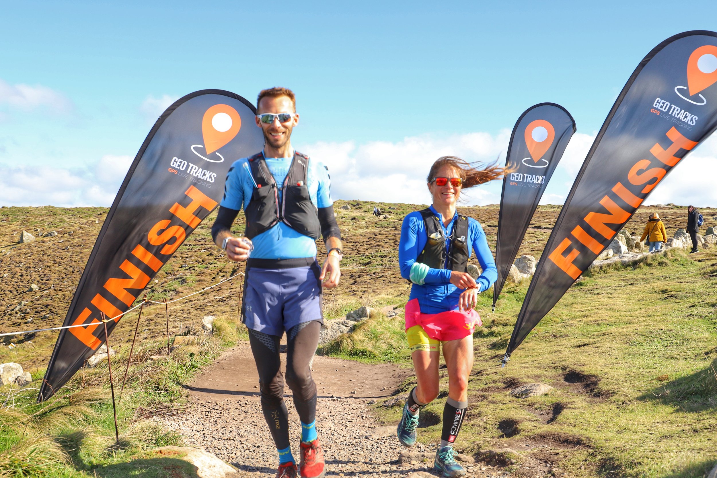
Choose Geo Tracks as your trusted partner for both event Tracking and Timing
What is GPS timing?
Live, real-time technology that uses satellite signals to synchronize and record times for participants instantly. Unlike RFID or manual timing, GPS timing delivers automated, accurate data that supports live leaderboards, keeping participants and spectators up-to-date with real-time results.
Geo fences (virtual areas that record when a tracker has pinged in them) are used to provide a time-stamp at the start and finish as well as checkpoints along the route.
main considerations
-
Real-Time Updates: Unlike manual methods, GPS timing provides instant updates, allowing for live tracking and real-time leaderboard displays.
Wide Coverage: GPS timing can operate anywhere there’s access to satellites, making it suitable for outdoor events with large areas, like marathons or cycling races.
Reduced Human Error: By automating the timing, GPS timing minimises potential timing inaccuracies that can occur with manual timing.
Integration with Tracking: GPS timing can seamlessly integrate with GPS tracking, allowing event organisers to monitor both location and timing data in one system.
-
GPS timing is suited to longer distance events such as ultra runs and bike packing events. It is not suited to short events such as 10km road runs.
One of the defining factors is the logistics around issuing, carrying and returning the GPS trackers.
-
Accuracy is determined by four main factors.
The ping rate of the tracker. This needs to be relatively fast at the timing point to ensure the time stamp is as close to the finish line as possible. Geo Tracks trackers are sped up to ping once every second as they approach the finish line
The ± accuracy of the GPS tracking device. The more accurate the location of the ping the more accurate the results is. Geo Tracks trackers have a ± of 5 meters
Accuracy of the finish geo fence. Organisers need to give a very accurate report of exactly where their finish line is so that Geo Track developers can place the geo-fence finish line in the correct position
Level of mobile signal. Geo Tracks trackers operate on multi-network SIMS and only need a low level of signal to operate but the better the signal level the better the accuracy of the results

-
GPS timing is an additional service offered alongside Geo Tracks GPS tracking service.
Using the data provided by the GPS trackers, the GPX file of the course and the geo-fences at check points and the finish, Geo Tracks is able to produce this as a live leaderboard with split times, finish times and playback options.
-
Briefly, we use a series of ‘Geo Fences’ to record the tracker’s time stamp along the events GPX track. The geo-fences can be set at the start to give individual start times, at checkpoints and at the finish location. When the tracker ‘pings’ in the geo-fence our system applies logic to calculate a time / result at that position
-
In general GPS timing is suitable for long-distance events.
The tracker's ping rate is sped up to ping once every second as they approach the finish geo-fence and the trackers generally give an accuracy of ± 5 meters. So two runners finishing side by side could have finish times a few seconds apart depending on what ping cycle the tracker is in.
The actual accuracy depends on a few factors.
Ping rate of the tracker
Good mobile comms
Well-defined finish geo- fence area
-
Yes. The results show both the split time between each check point and also the accrued total time at each check point.
-
No, the data is derived from the trackers, so the event has to be tracked to provide the data for the timing
-
Yes! See our ‘Whats tracking’ page for 100’s of past events we have tracked and timed.
-
Yes. There is a addtional charge due to the management required to produce the results and mange the Geo Tracks system.
-
Firstly you need the ‘Live View Tracking Map’ link from the event organisers.
On the mobile screen version click the ‘burger’ menu in the top left of the screen, then click leader board.
On the laptop screen click the map and tracker icon on the left hand side of the page.
-
Yes, the results page shows all the normal participant infomation and can be ordered by category.
The organiser needs to supply all the raw data such as gender, DOB etc in order for categories to be shown
“Your trackers were brilliant and your support was amazing. The trackers were spot on and it was so easy to see where everyone was. Getting the incredibly quick and instant access to the results without having to do anything was a real bonus. I’ve never had such confidence in technology. When I first did this race 11 years ago, the height of technology was a stop watch that recorded all the splits! Thank you so much.”
— Kevin and the Positive Steps Events Team.
